Lezo, a fifth-class municipality in the Province of Aklan, Philippines, is the smallest in the province in terms of land area and population yet it reflects a lively community molded by its agricultural past and cultural legacy. Guided by the Local Government Code of 1991, Lezo’s small population belies its socio-economic importance inside Aklan’s second congressional district. Using old municipal records, data from the LGU Community-Based Monitoring System (CBMS), and current web sources as of February 28, 2025, this in-depth profile employs These comprise government websites, local news, and reports from departments including the Department of Environment and Natural Resources ( DENR) and the Department of Education ( DepEd). Acting as a key instrument for planning, development, and stakeholder involvement, the paper seeks to give a thorough summary of Lezo’s geographic, demographic, economic, social, environmental, infrastructure, and governance features.
Geographic Characteristics
About 7.5 kilometers west of the province capital, Kalibo, Lezo sits strategically in northwest Aklan, flanked by Numancia to the north, Kalibo and Banga to the east, Malinao to the south, and Makato to the west. Comprising only 1.28% of Aklan’s total land area, the municipality covers 23.40 square kilometers (2,340 hectares) at coordinates 11°40′N latitude and 122°20′E longitude. Its topography combines gently sloping hills with rich plains, crossed by the Aklan River, which supports farming and shapes human habitation. Lezo has a Type III tropical monsoon climate, marked by a strong rainy season from June to November and a dry season from December to May, therefore affecting agricultural cycles and creating seasonal flood hazards. Though these assets need appropriate management to reduce environmental strain, the municipality’s natural resources include fertile ground ideal for varied crops, remnant forest patches, and the Aklan River, which also generates sand and gravel for building.
Background Information
Reflecting its early natural richness, Lezo’s history starts with its origins as a barrio of Kalibo called “Guicod,” derived from “Guicab,” meaning “a cavern in a creek where eels abound.” Known as “Tierra Alta,” or “high land,” the area became well-known during Spanish colonial control for its raised, flood-resistant topography. Though historical records vary, local officials successfully petitioned for autonomy in 1865, founding Lezo as a municipality on July 6, most likely named for a Spanish naval officer. Before attaining permanent independence on January 1, 1945, via Executive Order No. 364 signed by President Manuel Quezon, its journey to permanence encountered difficulties including annexation by Kalibo in 1903 and inclusion into Numancia in 1920. Lezo’s annual celebration of its legacy reflects this resiliency in both its communal spirit and ongoing ceramic history.
Demographic Data
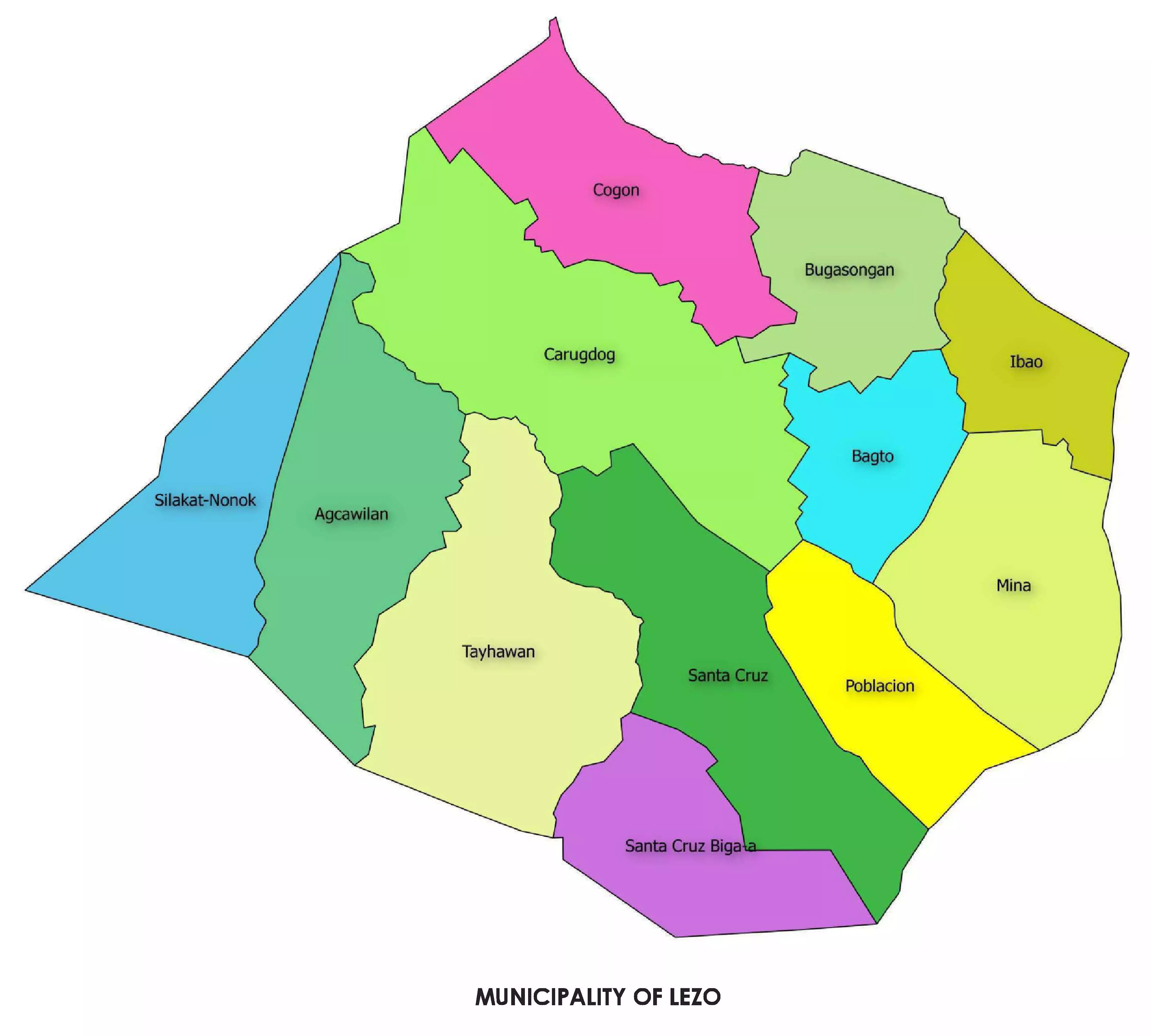
Lezo’s population was recorded at 15,639 in the 2020 PSA Census with an annual growth rate of 0.56% from 2010; the 2022 CBMS recorded 15,095 residents—7,681 men and 7,414 women—indicating a minor decline or data variance. Agcawilan, Bagto, Bugasongan, Carugdog, Cogon, Ibao, Mina, Poblacion, Santa Cruz, Santa Cruz Bigaa, Silakat-Nonok, and Tayhawan span 23.40 square kilometers and translate to a population density of 668 persons per square kilometer (2020) or 645 (2022), distributed across 12 barangays. With 25.23% (3,609) under 15 years, 62.85% (9,487) aged 15–64, and 11.92% (1,799) over 65, the age structure shows a youthful demographic with a dependence ratio of almost 59.2%, balancing dependents with economic contributors. Though historical trends suggest a former feminine edge, gender distribution reveals a small masculine tilt at 1.04 men per female.
With 4,525 households polled, 3,930 respondents (86.98%) averaging 3.84 persons per household and 3.81 per family, with 1.27 nuclear families apiece, With 1,828 people living across 472 households, Poblacion leads; Silakat-Nonok trails with 877 across 222. The main language is Aklanon, which reflects Lezo’s location in Western Visayas’ cultural fabric by means of Hiligaynon influences.
Finance
Leveraging rich soil and riverine irrigation to grow rice, corn, coconuts, bananas, vegetables, and root crops, agriculture constitutes the pillar of Lezo’s economy. Of the 11,286 residents aged 15 and above, 54.52% (6,153) join in the labor force; many of them work in farming, so generating an employment rate of 94.96% (5,843); an unemployment rate of 5.04% (310); and an underemployment rate of 10.51% (614). Men show a 66.64% involvement rate and 95.78% employment; women at 42.20% and 93.61% have peak activity at ages 45–54 (72.64%). and Tayhawan leading barangays at 63.11%. Though its use creates environmental questions, the Aklan River helps this industry by supplying water and extractible sand and gravel for building.
Lezo sets itself apart with handcrafted goods, most notably pottery—a centuries-old legacy—and ampaw (puffed rice), therefore earning it respect as Aklan’s pottery center with small-scale abaca and piña cloth weaving. Being close to Kalibo’s markets improves trade; Lezo keeps a rural economic character as its size and resources prevent industrial development. From 2.6% in December 2024, inflation in Western Visayas increased to 2.9% in January 2025, implying little strain on local livelihoods.
Social Profile
With nine elementary schools (eight public, one private) and three secondary schools (two public, one private), serving a young population where 80.57% of those aged 3–24 (4,662 of 5,786) attend school, peaking at 99-100% for ages 9–13 but dropping to 4.52% by age 24, with tertiary students most likely travelling to Kalibo. Of the 991 non-attending 16–24-year-olds, 25.33% are senior high school graduates and 24.52% are college educated, therefore indicating a strong educational background. 29.77% have finished schooling, 18.06% mention financial constraints, 15.54% work, and 15.46% of women indicate pregnancy.
Though sophisticated care needs travel to Kalibo’s hospitals, 7.5 kilometers distant, which presents difficulties for remote communities, healthcare depends on a rural health unit in Poblacion, a birthing clinic, and a station in Carugdog. With 88.35% of roofs (3,472) in galvanized iron, 46.84% of walls (1,841) in concrete/brick/stone, and 77.91% of floors (3,062) in concrete, housing displays durability. Rural Mina retains 38.96% earth flooring, therefore accentuating differences. While social services—poverty help, housing support, and disaster relief—bolster resilience, seen by an 86.98% CBMS response rate—culturally the Bayangan Festival in May promotes pottery and ampaw, hence encouraging community pride.
Ecological Profile
Lezo’s surroundings strike a compromise between natural weaknesses and agricultural output. While seasonal flooding threatens lowlands during typhoons, balanced by mountainous terrain, fertile plains and the Aklan River support agricultural. Reduced by development, forests still show up in fragments that maintain biodiversity. Although commercially advantageous, sand and gravel mining from the river runs the danger of causing environmental damage and calls for sustainable development. Although sanitation statistics is lacking, rural standards point to simple systems with possible improvements via provincial efforts vital in flood-prone areas.
Infrastructure
Though rural wear endures, eased by 97.63% power connection (3,837 of 3,930 homes), roads and bridges link Lezo to Kalibo and neighbors. Bugasongan boasts strongest at 98.81%. Though specifics are unknown, water most likely comes from wells and the Aklan River piped infrastructure in Poblacion. Reflecting developments in rural connectivity, mobile data exceeds fixed internet. Schools, barangay halls, and a Poblacion-adjacent market anchor public space supporting daily life and business.
Governorance
Municipal Mayor is Mary Lenette R. Fernandez. Ex-officio members Albane S. Nepomuceno (Liga ng mga Barangay) and Glenn Paulo R. Reyes (Sangguniang Kabataan) join Vice Mayor George R. Villarubia, whose Sangguniang Bayan consists of Peter Cyril B. Besana, Gwyn Zeus Lorens R. Dela Cruz, Meekia F. Icasas, Ulysses R. Irabon, Ermeda L. Morales, Rafael M. Silverio, Romy R. Abello, and Rodulfo M. Taran. Despite fourth-class budgetary constraints (as of 2025), it gives agricultural, tourism via pottery and celebrations top priority across twelve barangays, as well as infrastructure. Anticipating the 2024 CBMS for revised planning insights,
Conclusions
Lezo is a small but energetic municipality with a strong tradition of pottery and agricultural activity supporting a 15,095 strong community. Though problems still exist—gender inequities in work, underemployment, healthcare access, and environmental hazards from flooding and resource extraction—strengths include near-universal electricity, high rates of schooling, and durable homes. Lezo should upgrade rural infrastructure, control river resource usage, increase healthcare access, and so promote its cultural assets regionally, in line with Aklan’s development objectives, so improving its trajectory. Once accessible, the 2024 CBMS will help to prioritize these issues so guaranteeing sustainable development for this tiny but energetic town.